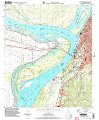
1998 Map of Vicksburg West
USGS Topo · Published 2003About this map
Vicksburg stands at a dramatic bend where the Mississippi River and Yazoo River converge, a landscape defined by its Civil War legacy and complex hydrology. The presence of Vicksburg Nat Mil Park and the nearby Grants Canal across the river at Delta marks the site of pivotal maneuvers during the 1863 campaign. By the late 20th century, the river's path shows the permanence of the Centennial Cutoff, which transformed the former river channel into Centennial Lake and created De Soto Island. On the high ground of the city, educational and religious life is anchored by All Saints College, St Francis Sch, and Cooper High Sch. Further south along the bluffs, smaller settlements like Stout and Cedars appear near the winding paths of Stouts Bayou and Hatcher Bayou.
Find a feature on this map
35 named features on this map. Tap any name to fly to it.
Don’t see what you’re looking for? This feature index may not catch every label — zoom into the map to look around manually.
Map Details
Editions of this 1998 Vicksburg West Map
This is the sole edition of this map. No revisions or reprints were ever made.
Other maps of this area

1909 · Millikens Bend
USGS Topo · 1:24,000

1909 · Mound
USGS Topo · 1:24,000

1910 · Mound
USGS Topo · 1:31,680

1918 · Vicksburg
USGS Topo · 1:62,500

1939 · Talla Bena
USGS Topo · 1:62,500

1939 · Yokena
USGS Topo · 1:62,500

1941 · Vicksburg
USGS Topo · 1:62,500

1955 · Jackson
USGS Topo · 1:250,000

1961 · Jackson
USGS Topo · 1:250,000

1962 · Jackson
USGS Topo · 1:250,000