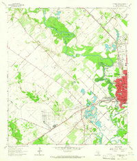
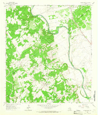
1964 Map of Victoria West
USGS Topo · Published 1965About this map
The Guadalupe River carves a dramatic, winding path through this 1964 survey, defining the landscape with sharp oxbows and bends like Powers Bend, Grovers Bend, and Foxes Bend. On the western outskirts of Victoria, the map documents a transitional period of land use where agricultural fields meet industrial expansion. The presence of the Aloe Field landing strips and the adjacent Aloe settlement highlights the region's aviation and military footprint, while the Victoria Oil Field and Pridham Lake Oil Field indicate the importance of petroleum extraction to the local economy.
Find a feature on this map
43 named features on this map. Tap any name to fly to it.
Don’t see what you’re looking for? This feature index may not catch every label — zoom into the map to look around manually.
Map Details
Editions of this 1964 Victoria West Map
4 editions found
Other maps of this area

1951 · Bloomington
USGS Topo · 1:24,000

1951 · Inez NW
USGS Topo · 1:24,000

1952 · Victoria East
USGS Topo · 1:24,000

1953 · Beeville
USGS Topo · 1:250,000

1956 · Beeville
USGS Topo · 1:250,000

1960 · Beeville
USGS Topo · 1:250,000

1962 · Fannin
USGS Topo · 1:24,000

1962 · Raisin
USGS Topo · 1:24,000

1963 · Nursery
USGS Topo · 1:24,000
1963 · Mission Valley
USGS Topo · 1:24,000