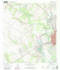
1964 Map of Victoria West
USGS Topo · Published 1987About this map
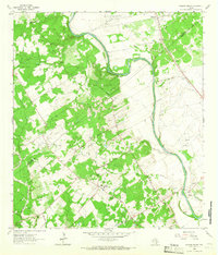
The Guadalupe River meanders through this portion of Victoria County, shaping the landscape with dramatic oxbows and bends such as Powers Bend, Grovers Bend, and Foxes Bend. During the mid-1960s, the western edge of Victoria shows a transition from urban development to a resource-rich periphery dominated by the Victoria Oil Field and numerous gravel pits. This intersection of industrial utility and civic space is evident in the proximity of the Municipal Park Riverside Golf Course to local extraction sites. Notable local infrastructure includes the Southern Pacific railroad line passing through the small community of Aloe, and various rural landmarks such as Goldmans Hill and Pleasure Island. Several legacy sites like St Josephs Cem, Catholic Cem, and the Hope Development Sch provide specific points of interest for those researching local family history and community growth during this era.
Find a feature on this map
49 named features on this map. Tap any name to fly to it.
Don’t see what you’re looking for? This feature index may not catch every label — zoom into the map to look around manually.
Map Details
Editions of this 1964 Victoria West Map
4 editions found
Other maps of this area

1951 · Bloomington
USGS Topo · 1:24,000

1951 · Inez NW
USGS Topo · 1:24,000

1952 · Victoria East
USGS Topo · 1:24,000

1953 · Beeville
USGS Topo · 1:250,000

1956 · Beeville
USGS Topo · 1:250,000

1960 · Beeville
USGS Topo · 1:250,000

1962 · Fannin
USGS Topo · 1:24,000

1962 · Raisin
USGS Topo · 1:24,000

1963 · Nursery
USGS Topo · 1:24,000
1963 · Mission Valley
USGS Topo · 1:24,000