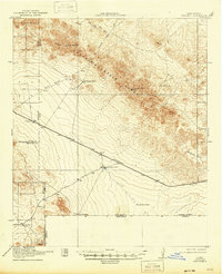
1918 Map of Victorio
USGS Topo · Published 1948About this map
The Cedar Mountain Range dominates this high-desert landscape in the years before the First World War, forming a diagonal spine across the territory. This 1917 survey captures a remote ranching and mining district along the New Mexico Chihuahua border, where life revolved around scattered water sources like Wamels Upper Well, Wamels Lower Well, and Doyles Well. The southwestern portion of the map is marked by the Sierra Rica Mines and Occidental Mines, indicating the mineral interests that drew settlers to this arid region near the international Boundary Line.
Find a feature on this map
24 named features on this map. Tap any name to fly to it.
Don’t see what you’re looking for? This feature index may not catch every label — zoom into the map to look around manually.
Map Details
Editions of this 1918 Victorio Map
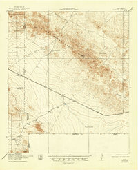
Other maps of this area

1899 · Deming
USGS Topo · 1:125,000

1915 · Deming
USGS Topo · 1:125,000

1917 · Hermanas
USGS Topo · 1:62,500

1918 · Big Hatchet Peak
USGS Topo · 1:62,500

1918 · Hachita
USGS Topo · 1:62,500

1918 · Hermanas
USGS Topo · 1:62,500

1918 · Victorio
USGS Topo · 1:62,500

1943 · Hermanas
USGS Topo · 1:62,500

1953 · El Paso
USGS Topo · 1:250,000

1954 · Silver City
USGS Topo · 1:250,000