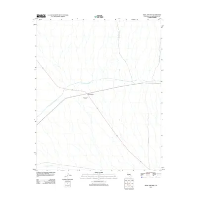
2012 Map of Vidal Junction
USGS Topo · Published 2012About this map
Vidal Junction serves as the primary hub of activity in this desert landscape within San Bernardino County, defined by the intersection of major highway routes and the presence of the Vidal Junction Airport. The infrastructure of the region is dominated by the Colorado River Aqueduct, which cuts across the terrain as a critical piece of water engineering. Smaller drainage patterns like Vidal Wash thread through the area, while historical connectivity is represented by thoroughfares such as Independence Mine Rd and Chambers Well Rd. This survey documents a quiet crossroads at a time when its utility was defined by its role as a transportation and utility corridor through the arid interior of California.
Find a feature on this map
6 named features on this map. Tap any name to fly to it.
Don’t see what you’re looking for? This feature index may not catch every label — zoom into the map to look around manually.
Map Details
Editions of this 2012 Vidal Junction Map
This is the sole edition of this map. No revisions or reprints were ever made.
Other maps of this area

1911 · Parker
USGS Topo · 1:125,000

1943 · Whipple Mts.
USGS Topo · 1:62,500

1943 · Parker
USGS Topo · 1:62,500

1943 · Vidal
USGS Topo · 1:62,500

1949 · Parker
USGS Topo · 1:62,500

1949 · Vidal
USGS Topo · 1:62,500

1950 · Parker
USGS Topo · 1:62,500

1950 · Vidal
USGS Topo · 1:62,500

1950 · Whipple Mts
USGS Topo · 1:62,500

1950 · Savahia Peak
USGS Topo · 1:62,500