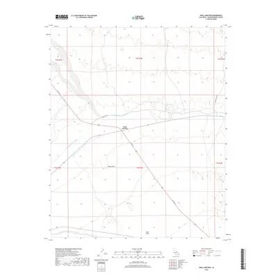
2018 Map of Vidal Junction
USGS Topo · Published 2018About this map
Vidal Junction serves as a critical desert crossroads in San Bernardino County, where US Rte 95 meets several local desert routes. The landscape is defined by the expanse of the Mojave Desert, characterized here by the broad Vidal Valley and the dry path of Vidal Wash. A significant industrial feat, the Colorado River Aqueduct traverses the terrain, flanked by Aquaduct Rd, illustrating the massive infrastructure required to transport water across this arid region. Near the eastern edge, Chambers Well Rd provides access through the high desert, while the grid of township and range lines, such as t1n r23e, organizes the vast open spaces of the California interior during this contemporary era.
Find a feature on this map
14 named features on this map. Tap any name to fly to it.
Don’t see what you’re looking for? This feature index may not catch every label — zoom into the map to look around manually.
Map Details
Editions of this 2018 Vidal Junction Map
This is the sole edition of this map. No revisions or reprints were ever made.
Other maps of this area

1911 · Parker
USGS Topo · 1:125,000

1943 · Whipple Mts.
USGS Topo · 1:62,500

1943 · Parker
USGS Topo · 1:62,500

1943 · Vidal
USGS Topo · 1:62,500

1949 · Parker
USGS Topo · 1:62,500

1949 · Vidal
USGS Topo · 1:62,500

1950 · Parker
USGS Topo · 1:62,500

1950 · Vidal
USGS Topo · 1:62,500

1950 · Whipple Mts
USGS Topo · 1:62,500

1950 · Savahia Peak
USGS Topo · 1:62,500