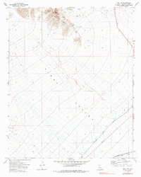
1971 Map of Vidal NW
USGS Topo · Published 1985About this map
The Turtle Mountains dominate the northern horizon of this San Bernardino County landscape, rising sharply above the expansive Vidal Valley. This 1971 survey highlights a region of significant infrastructure crossing the arid terrain, most notably the Colorado River Aqueduct as it cuts diagonally across the valley floor. The map documents the vital transportation and utility corridors of the early 1970s, including the Atchison Topeka and Santa Fe railroad line running through the southern section near Vidal. Local topography is punctuated by prominent landmarks such as Negro Peak, providing essential orientation points for those navigating the numerous Jeep Trails that spiderweb across the alluvial fans and desert floor.
Find a feature on this map
13 named features on this map. Tap any name to fly to it.
Don’t see what you’re looking for? This feature index may not catch every label — zoom into the map to look around manually.
Map Details
Editions of this 1971 Vidal NW Map
2 editions found

Other maps of this area

1943 · Turtle Mts.
USGS Topo · 1:62,500

1943 · Vidal
USGS Topo · 1:62,500

1949 · Vidal
USGS Topo · 1:62,500

1950 · Vidal
USGS Topo · 1:62,500

1950 · Savahia Peak
USGS Topo · 1:62,500

1951 · Savahia Peak
USGS Topo · 1:62,500

1954 · Needles
USGS Topo · 1:250,000

1954 · Turtle Mountains
USGS Topo · 1:62,500

1954 · Rice
USGS Topo · 1:62,500

1956 · Needles
USGS Topo · 1:250,000