
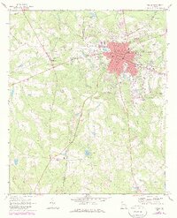
1970 Map of Vidalia
USGS Topo · Published 1973About this map
The city of Vidalia serves as the primary hub on this Toombs County landscape, where the Seaboard Coast Line and Georgia Central rail corridors intersect. The map illustrates a transitional period of growth, featuring established institutions like Dickerson High Sch and City Hall alongside the emerging infrastructure of the Vidalia Municipal Airport. Beyond the urban center, the terrain is defined by the Montgomery Co and Toombs Co boundary line, which cuts through agricultural lands and timber tracts.
Find a feature on this map
43 named features on this map. Tap any name to fly to it.
Don’t see what you’re looking for? This feature index may not catch every label — zoom into the map to look around manually.
Map Details
Editions of this 1970 Vidalia Map
2 editions found
Other maps of this area

1957 · Macon
USGS Topo · 1:250,000

1958 · Macon
USGS Topo · 1:250,000

1964 · Macon
USGS Topo · 1:250,000

1970 · Johnson Corner
USGS Topo · 1:24,000

1970 · Alston
USGS Topo · 1:24,000

1970 · Oak Park SW
USGS Topo · 1:24,000

1970 · Mount Vernon
USGS Topo · 1:24,000

1970 · Uvalda
USGS Topo · 1:24,000

1970 · Lyons
USGS Topo · 1:24,000

1970 · Oak Park
USGS Topo · 1:24,000