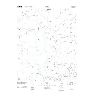
2013 Map of Vienna
USGS Topo · Published 2013About this map
The Meadows and Heritage Village mark the northern reaches of this Winston-Salem fringe area, where the Yadkin River and its tributary Little Yadkin River carve through the North Carolina landscape. This 2013 survey illustrates a transition from established rural communities like Donnaha and Macedonia to suburban residential developments such as Sherwood Forest, Vienna Forest, and River Ridge Run. The local hydrology is defined by numerous winding waterways including Bashavia Cr and Fries Cr, which feed into larger river systems. Genealogists and historians can trace the evolution of early crossings at Sycamore Ford Rd and the persistent importance of locations like Enon and Vienna in the southern portion of the quadrangle. Small-scale water features like Soloman Lake and Trading Post Lake emphasize the pocketed development of this region just west of the city.
Find a feature on this map
206 named features on this map. Tap any name to fly to it.
Don’t see what you’re looking for? This feature index may not catch every label — zoom into the map to look around manually.
Map Details
Editions of this 2013 Vienna Map
This is the sole edition of this map. No revisions or reprints were ever made.
Other maps of this area

1891 · Yadkinville
USGS Topo · 1:125,000

1893 · Yadkinville
USGS Topo · 1:125,000

1950 · Winston-Salem West
USGS Topo · 1:24,000

1951 · Winston-Salem West
USGS Topo · 1:24,000

1951 · Rural Hall
USGS Topo · 1:24,000

1953 · Winston-Salem
USGS Topo · 1:250,000

1955 · Winston-Salem
USGS Topo · 1:250,000

1962 · Winston-Salem
USGS Topo · 1:250,000

1964 · Pinnacle
USGS Topo · 1:24,000

1964 · King
USGS Topo · 1:24,000