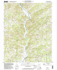
1997 Map of Vienna
USGS Topo · Published 2000About this map
The Yadkin River defines the landscape of this region, winding through the borders of Surry, Forsyth, and Yadkin Counties. Along its banks, the small settlement of Donnaha sits at a bend where the river transitions from North to South, while higher ground to the west is occupied by East Bend and Stony Knoll. The eastern side of the river features a dense network of rural roads such as Old Ridge Road and Seward Road, connecting established communities like Vienna and Seward.
Find a feature on this map
55 named features on this map. Tap any name to fly to it.
Don’t see what you’re looking for? This feature index may not catch every label — zoom into the map to look around manually.
Map Details
Editions of this 1997 Vienna Map
This is the sole edition of this map. No revisions or reprints were ever made.
Other maps of this area

1891 · Yadkinville
USGS Topo · 1:125,000

1893 · Yadkinville
USGS Topo · 1:125,000

1950 · Winston-Salem West
USGS Topo · 1:24,000

1951 · Winston-Salem West
USGS Topo · 1:24,000

1951 · Rural Hall
USGS Topo · 1:24,000

1953 · Winston-Salem
USGS Topo · 1:250,000

1955 · Winston-Salem
USGS Topo · 1:250,000

1962 · Winston-Salem
USGS Topo · 1:250,000

1964 · Pinnacle
USGS Topo · 1:24,000

1964 · King
USGS Topo · 1:24,000