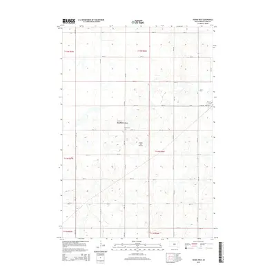
2015 Map of Vienna West
USGS Topo · Published 2015About this map
Coteau des Prairies, a vast glacial plateau, defines the rolling topography of this Clark County landscape. The settlement of Vienna anchors the eastern edge of the map, where the street grid of Clark Ave and Grant Ave meets the surrounding agricultural section lines. This area is characterized by a high density of small prairie potholes and wetlands, interspersed with a rigid network of county roads like Cr-45 and Cr-36. The Mayfield Colony represents a distinct communal settlement pattern in the central part of the quadrangle, located near Pleasant Cem. To the northeast, the Vienna Cem serves as a significant local genealogical landmark, overlooking the depressions and rises that characterize this portion of the South Dakota plains during the early twenty-first century.
Find a feature on this map
32 named features on this map. Tap any name to fly to it.
Don’t see what you’re looking for? This feature index may not catch every label — zoom into the map to look around manually.
Map Details
Editions of this 2015 Vienna West Map
This is the sole edition of this map. No revisions or reprints were ever made.
Other maps of this area

1953 · Watertown
USGS Topo · 1:250,000

1958 · Watertown
USGS Topo · 1:250,000

1973 · Willow Lake
USGS Topo · 1:24,000

1973 · Clark South
USGS Topo · 1:24,000

1973 · Bryant
USGS Topo · 1:24,000

1973 · Vienna West
USGS Topo · 1:24,000
1973 · Cherry Lake
USGS Topo · 1:24,000

1973 · Naples
USGS Topo · 1:24,000
1973 · Willow Lake SW
USGS Topo · 1:24,000

1973 · Vienna East
USGS Topo · 1:24,000