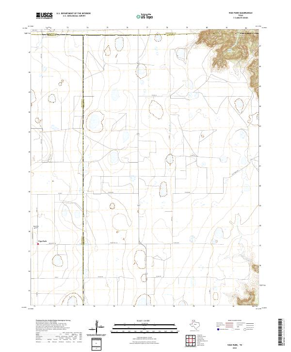
2022 Map of Vigo Park
USGS Topo · Published 2022About this map
Vigo Park stands as the primary settlement in this High Plains region, situated at the junction of several rural routes including Ranch Rd 146 and Co Rd 29. The landscape is defined by the sharp transition between the flat agricultural tableland and the deeply eroded canyon topography of the northeast, where Mulsey Springs emerges among the breaks.
Find a feature on this map
19 named features on this map. Tap any name to fly to it.
Don’t see what you’re looking for? This feature index may not catch every label — zoom into the map to look around manually.
Map Details
Editions of this 2022 Vigo Park Map
This is the sole edition of this map. No revisions or reprints were ever made.
Other maps of this area

1954 · Plainview
USGS Topo · 1:250,000

1958 · Plainview
USGS Topo · 1:250,000

1960 · Wayside
USGS Topo · 1:62,500

1963 · Pleasant Creek
USGS Topo · 1:24,000
1963 · Gip Creek
USGS Topo · 1:24,000

1965 · Ross Canyon
USGS Topo · 1:24,000

1965 · Big Betty Reservoir
USGS Topo · 1:24,000

1965 · Vigo Park
USGS Topo · 1:24,000

1965 · Cope Creek
USGS Topo · 1:24,000

1969 · Love
USGS Topo · 1:24,000