
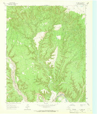
1965 Map of Vigo Park
USGS Topo · Published 1967About this map
Vigo Park and the surrounding High Plains of the Texas Panhandle appear here in the mid-1960s, a landscape defined by extensive ranching and scattered agricultural outposts. The settlement of Fleming and the San Jacinto Sch serve as community anchors for the local families managing the large landholdings that dominate this quadrangle. These named tracts, including the Hall Ranch, McMurtry Farm, Hulsey Ranch, Tule Ranch, and Cobb Ranch, reflect the area's deep-rooted ranching heritage.
Find a feature on this map
14 named features on this map. Tap any name to fly to it.
Don’t see what you’re looking for? This feature index may not catch every label — zoom into the map to look around manually.
Map Details
Editions of this 1965 Vigo Park Map
This is the sole edition of this map. No revisions or reprints were ever made.
Other maps of this area

1954 · Plainview
USGS Topo · 1:250,000

1958 · Plainview
USGS Topo · 1:250,000

1960 · Wayside
USGS Topo · 1:62,500

1963 · Pleasant Creek
USGS Topo · 1:24,000
1963 · Gip Creek
USGS Topo · 1:24,000

1965 · Ross Canyon
USGS Topo · 1:24,000

1965 · Big Betty Reservoir
USGS Topo · 1:24,000

1965 · Cope Creek
USGS Topo · 1:24,000

1969 · Love
USGS Topo · 1:24,000

1969 · Jackson Hill
USGS Topo · 1:24,000