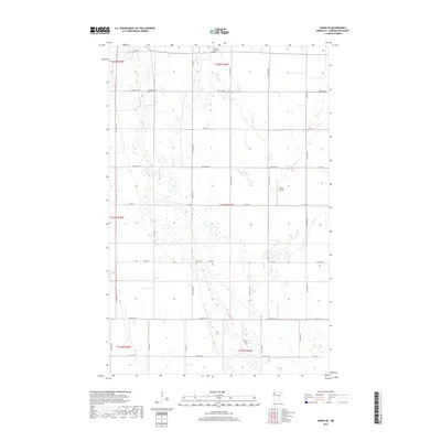
2019 Map of Viking SE
USGS Topo · Published 2019About this map
Norden Lutheran Cem and Lanstad Cem sit within a landscape of section-line roads and marshy lowlands in this northern Minnesota survey. The terrain is defined by a dense network of wetlands and small ponds, illustrating the glacial heritage of Pennington County. While primarily rural and agricultural, the presence of the Willis Airport along Center Ave N indicates a reliance on regional aviation in this flat, open country. Further south, the Rux Cem serves as another focal point for local family history, situated near the intersection of Co Rd 57 and NW 130th Ave. This late 2010s map captures the enduring township and range system, where county highways like Co Hwy 8 and Co Hwy 13 facilitate travel between scattered homesteads and the surrounding prairies.
Find a feature on this map
38 named features on this map. Tap any name to fly to it.
Don’t see what you’re looking for? This feature index may not catch every label — zoom into the map to look around manually.
Map Details
Editions of this 2019 Viking SE Map
This is the sole edition of this map. No revisions or reprints were ever made.
Other maps of this area

1918 · Terrebonne
USGS Topo · 1:62,500

1918 · Red Lake Falls
USGS Topo · 1:62,500

1918 · Viking
USGS Topo · 1:62,500

1943 · Thief River Falls
USGS Topo · 1:62,500

1952 · Red Lake Falls
USGS Topo · 1:62,500

1952 · Grand Forks
USGS Topo · 1:250,000

1952 · Thief River Falls
USGS Topo · 1:250,000

1956 · Thief River Falls
USGS Topo · 1:250,000

1956 · Grand Forks
USGS Topo · 1:250,000

1957 · Thief River Falls
USGS Topo · 1:250,000