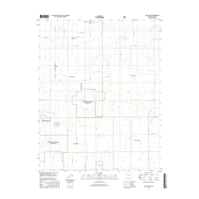
2016 Map of Vilas South
USGS Topo · Published 2016About this map
Vilas sits at the northern edge of this southeastern Colorado landscape, serving as a gateway to the extensive public lands of the Comanche National Grassland. The terrain is defined by the intermittent drainage patterns of Sand Arroyo Cr and Dry Cr, which carve subtle relief into the High Plains. A dense grid of section roads, including Co RD BB and Co RD 36, provides structured access to the livestock grazing and conservation areas that dominate the township boundaries of t31s r45w and t31s r44w. These roads follow the precise Public Land Survey System lines, reflecting the region's history of agricultural settlement and the later transition of marginal farmlands back to protected prairie under federal management.
Find a feature on this map
38 named features on this map. Tap any name to fly to it.
Don’t see what you’re looking for? This feature index may not catch every label — zoom into the map to look around manually.
Map Details
Editions of this 2016 Vilas South Map
This is the sole edition of this map. No revisions or reprints were ever made.
Other maps of this area

1891 · Springfield
USGS Topo · 1:125,000

1892 · Vilas
USGS Topo · 1:125,000

1893 · Springfield
USGS Topo · 1:125,000

1955 · La Junta
USGS Topo · 1:250,000

1958 · La Junta
USGS Topo · 1:250,000

1968 · La Junta
USGS Topo · 1:250,000

1978 · Walsh SE
USGS Topo · 1:24,000
1978 · Walsh
USGS Topo · 1:24,000

1978 · Moore Draw NE
USGS Topo · 1:24,000

1978 · Campo NE
USGS Topo · 1:24,000