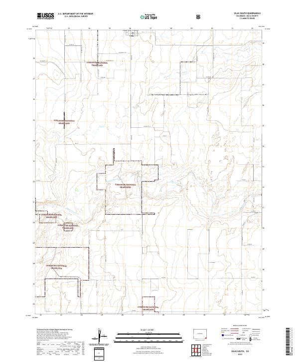
2022 Map of Vilas South
USGS Topo · Published 2022About this map
Comanche National Grassland dominates this corner of Baca County, where the high plains of southeastern Colorado meet a network of seasonal watercourses and section roads. The landscape is defined by the ephemeral drainage of Sand Arroyo Cr and Dry Cr, which carve subtle topography across the shortgrass prairie. The small community of Vilas sits at the northern edge of the map, serving as a hub for the sprawling agricultural and grazing lands that surround it. A rigid grid of county roads, including Co Rd Cc and Co Rd U, illustrates the enduring influence of the Public Land Survey System on the region's development. This 2022 survey captures a rural environment where land use is dictated by the availability of water and the vast boundaries of federally managed grasslands.
Find a feature on this map
20 named features on this map. Tap any name to fly to it.
Don’t see what you’re looking for? This feature index may not catch every label — zoom into the map to look around manually.
Map Details
Editions of this 2022 Vilas South Map
This is the sole edition of this map. No revisions or reprints were ever made.
Other maps of this area

1891 · Springfield
USGS Topo · 1:125,000

1892 · Vilas
USGS Topo · 1:125,000

1893 · Springfield
USGS Topo · 1:125,000

1955 · La Junta
USGS Topo · 1:250,000

1958 · La Junta
USGS Topo · 1:250,000

1968 · La Junta
USGS Topo · 1:250,000

1978 · Walsh SE
USGS Topo · 1:24,000
1978 · Walsh
USGS Topo · 1:24,000

1978 · Moore Draw NE
USGS Topo · 1:24,000

1978 · Campo NE
USGS Topo · 1:24,000