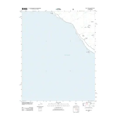
2012 Map of Villa Creek
USGS Topo · Published 2012About this map
Evans Brothers Cow Camp sits above a dramatic stretch of the California coast where steep drainages like Redwood Gulch and Villa Cr meet the Pacific Ocean. This 2012 survey by the U.S. Geological Survey and U.S. Forest Service captures a landscape of extreme vertical relief, defined more by its creek systems and primitive campsites than by any permanent town centers. Offshore landmarks like Whaleboat Rock and White Rock Number Two indicate the rocky and hazardous nature of the shoreline. The distribution of sites such as Cruickshank Campground and Buckeye Campground suggests a region primarily managed for recreation and resource protection. Notable water sources including Buckeye Spring and the upper reaches of Alder Cr are carefully mapped within the network of forest trails and high-clearance routes.
Find a feature on this map
15 named features on this map. Tap any name to fly to it.
Don’t see what you’re looking for? This feature index may not catch every label — zoom into the map to look around manually.
Map Details
Editions of this 2012 Villa Creek Map
This is the sole edition of this map. No revisions or reprints were ever made.
Other maps of this area

1919 · Piedras Blancas
USGS Topo · 1:62,500

1921 · Cape San Martin
USGS Topo · 1:62,500

1927 · Piedras Blancas
USGS Topo · 1:62,500

1941 · Cape San Martin
USGS Topo · 1:62,500

1942 · Cape San Martin
USGS Topo · 1:62,500

1947 · San Luis Obispo
USGS Topo · 1:250,000

1948 · San Luis Obispo
USGS Topo · 1:250,000
1948 · Cape San Martin
USGS Topo · 1:62,500
1949 · Villa Creek
USGS Topo · 1:24,000
1949 · Burro Mountain
USGS Topo · 1:24,000