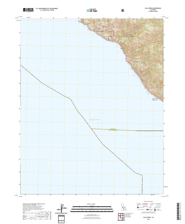
2021 Map of Villa Creek
USGS Topo · Published 2021About this map
The Santa Lucia Range rises steeply from the Pacific Ocean along this coastal stretch of the Los Padres National Forest. The landscape is defined by the sharp transition from marine environment to high ridges, where the Monterey Co San Luis Obispo Co line crosses the sea-facing slopes. Inland access is restricted to primitive paths like the Buckeye Trl and Cruickshank Trl, which navigate the deep drainages of Villa Creek and Redwood Gulch. Small freshwater sources such as Buckeye Spring provide rare points of interest in this high-relief terrain. Offshore, hazards like Whaleboat Rock and White Rock Number Two mark the treacherous shoreline where the Gorda Mt Rd provides the only significant vehicular infrastructure through the southern end of the quadrangle.
Find a feature on this map
17 named features on this map. Tap any name to fly to it.
Don’t see what you’re looking for? This feature index may not catch every label — zoom into the map to look around manually.
Map Details
Editions of this 2021 Villa Creek Map
This is the sole edition of this map. No revisions or reprints were ever made.
Other maps of this area

1919 · Piedras Blancas
USGS Topo · 1:62,500

1921 · Cape San Martin
USGS Topo · 1:62,500

1927 · Piedras Blancas
USGS Topo · 1:62,500

1941 · Cape San Martin
USGS Topo · 1:62,500

1942 · Cape San Martin
USGS Topo · 1:62,500

1947 · San Luis Obispo
USGS Topo · 1:250,000

1948 · San Luis Obispo
USGS Topo · 1:250,000
1948 · Cape San Martin
USGS Topo · 1:62,500

1949 · Villa Creek
USGS Topo · 1:24,000
1949 · Burro Mountain
USGS Topo · 1:24,000