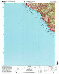
1995 Map of Villa Creek
USGS Topo · Published 2000About this map
The Cabrillo Highway threads along the steep California coastline in this 1995 revision, marking the primary artery through the protected landscapes of Monterey County. The interior is defined by the Silver Peak Wilderness and the Los Padres National Forest, where steep canyons like Dutton Gulch and drainage systems such as Villa Creek and Salmon Creek drop toward the Pacific.
Find a feature on this map
19 named features on this map. Tap any name to fly to it.
Don’t see what you’re looking for? This feature index may not catch every label — zoom into the map to look around manually.
Map Details
Editions of this 1995 Villa Creek Map
This is the sole edition of this map. No revisions or reprints were ever made.
Other maps of this area

1919 · Piedras Blancas
USGS Topo · 1:62,500

1921 · Cape San Martin
USGS Topo · 1:62,500

1927 · Piedras Blancas
USGS Topo · 1:62,500

1941 · Cape San Martin
USGS Topo · 1:62,500

1942 · Cape San Martin
USGS Topo · 1:62,500

1947 · San Luis Obispo
USGS Topo · 1:250,000

1948 · San Luis Obispo
USGS Topo · 1:250,000
1948 · Cape San Martin
USGS Topo · 1:62,500

1949 · Villa Creek
USGS Topo · 1:24,000
1949 · Burro Mountain
USGS Topo · 1:24,000