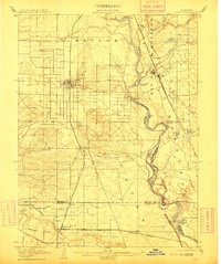
1904 Map of Vina
USGS Topo · Published 1911About this map
The Sacramento River dominates this landscape, its path defined by numerous bends, bars, and family-named landings that reflect an era when river traffic and irrigation were vital to the Central Valley. In the early 1900s, this region was already being transformed by significant water engineering, such as the Lemon Home Colony Canal, which supported the growing agricultural colonies near Corning. To the east, the community of Vina sits near a prominent Winery and the Southern Pacific RR Marysville Line, illustrating the importance of the rail-and-wine trade in Tehama County. The river itself is a complex network of features like Snaden Island and Missouri Bend, with the Squaw Hill Ferry providing a crucial link between the western farming towns and the riparian lands to the east. Large land grants like Rio De Los Molinos and Bosquejo still appear as defining administrative boundaries.
Find a feature on this map
56 named features on this map. Tap any name to fly to it.
Don’t see what you’re looking for? This feature index may not catch every label — zoom into the map to look around manually.
Map Details
Editions of this 1904 Vina Map
3 editions found
Other maps of this area

1886 · Lassen Peak
USGS Topo · 1:250,000

1890 · Red Bluff
USGS Topo · 1:250,000

1891 · Chico
USGS Topo · 1:125,000

1892 · Lassen Peak
USGS Topo · 1:250,000

1893 · Chico
USGS Topo · 1:125,000

1894 · Lassen Peak
USGS Topo · 1:250,000

1894 · Red Bluff
USGS Topo · 1:250,000

1895 · Chico
USGS Topo · 1:125,000

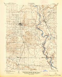
1904 · Vina
USGS Topo · 1:62,500

1904 · Walker Creek
USGS Topo · 1:31,680