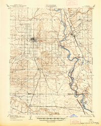
1904 Map of Vina
USGS Topo · Published 1947About this map
The Sacramento River meanders through the heart of the northern Sacramento Valley, defining a landscape shaped by early agricultural irrigation and river transit. Large land grants such as Saucos, Los Molinos, and Bosquejo dominate the terrain, reflecting the region's ranching heritage. The presence of a prominent Winery near Vina highlights the area's early viticulture, while several river access points like Merrill's Landing and Wilson Landing illustrate the river's role as a primary artery for commerce before the full maturation of the rail network.
Find a feature on this map
52 named features on this map. Tap any name to fly to it.
Don’t see what you’re looking for? This feature index may not catch every label — zoom into the map to look around manually.
Map Details
Editions of this 1904 Vina Map
3 editions found
Other maps of this area

1886 · Lassen Peak
USGS Topo · 1:250,000

1890 · Red Bluff
USGS Topo · 1:250,000

1891 · Chico
USGS Topo · 1:125,000

1892 · Lassen Peak
USGS Topo · 1:250,000

1893 · Chico
USGS Topo · 1:125,000

1894 · Lassen Peak
USGS Topo · 1:250,000

1894 · Red Bluff
USGS Topo · 1:250,000

1895 · Chico
USGS Topo · 1:125,000

1904 · Vina
USGS Topo · 1:62,500

1904 · Walker Creek
USGS Topo · 1:31,680