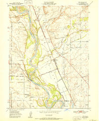
1951 Map of Vina
USGS Topo · Published 1951About this map
The Sacramento River anchors this mid-century survey of the northern Sacramento Valley, where water management and agricultural land grants define the landscape. Large historical tracts like Bosquejo, Saucos, and Los Molinos are clearly delineated, reflecting the region's ranching and horticultural roots. The small community of Vina sits east of the river, served by the Southern Pacific railroad and a complex network of irrigation works including the Main Canal and South Main Canal. Significant local drainage is managed through the Rio De Los Molinos and Deer Creek. Rural educational life is represented by the Moon School and Merrill School, while river access points like Merrills Landing and the Ferry Road suggest the historical importance of the water for transport and commerce before the expansion of more modern paved thoroughfares.
Find a feature on this map
37 named features on this map. Tap any name to fly to it.
Don’t see what you’re looking for? This feature index may not catch every label — zoom into the map to look around manually.
Map Details
Editions of this 1951 Vina Map
2 editions found
Other maps of this area

1886 · Lassen Peak
USGS Topo · 1:250,000

1890 · Red Bluff
USGS Topo · 1:250,000

1891 · Chico
USGS Topo · 1:125,000

1892 · Lassen Peak
USGS Topo · 1:250,000

1893 · Chico
USGS Topo · 1:125,000

1894 · Lassen Peak
USGS Topo · 1:250,000

1894 · Red Bluff
USGS Topo · 1:250,000

1895 · Chico
USGS Topo · 1:125,000

1904 · Vina
USGS Topo · 1:62,500

1905 · Tehama
USGS Topo · 1:62,500