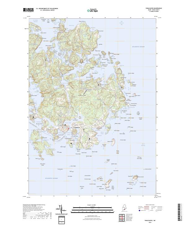
2024 Map of Vinalhaven
USGS Topo · Published 2024About this map
Vinalhaven serves as the central hub of this maritime landscape in Knox County, where the irregular granite coastline creates a complex network of sheltered coves and island passages. The map illustrates a community deeply tied to its geography, with local travel facilitated by roads like Hopkins Point Rd and Wharf Quarry Rd, reflecting the area's historic reliance on stone extraction and fishing. The interior of the island is dotted with flooded quarries such as Lawson Quarry Pond, now permanent features of the landscape alongside natural bodies like Round Pond and The Basin.
Find a feature on this map
216 named features on this map. Tap any name to fly to it.
Don’t see what you’re looking for? This feature index may not catch every label — zoom into the map to look around manually.
Map Details
Editions of this 2024 Vinalhaven Map
This is the sole edition of this map. No revisions or reprints were ever made.
Other maps of this area

1904 · Deer Isle
USGS Topo · 1:62,500

1904 · Vinalhaven
USGS Topo · 1:62,500

1905 · Penobscot Bay
USGS Topo · 1:125,000

1906 · Matinicus
USGS Topo · 1:62,500

1941 · Vinalhaven
USGS Topo · 1:62,500

1942 · Deer Isle
USGS Topo · 1:62,500

1944 · Vinalhaven
USGS Topo · 1:62,500

1944 · Deer Isle
USGS Topo · 1:62,500

1948 · Bangor
USGS Topo · 1:250,000

1948 · Bath
USGS Topo · 1:250,000