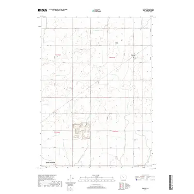
2018 Map of Vincent
USGS Topo · Published 2018About this map
The small settlement of Vincent serves as the focal point of this rural Webster County landscape, situated amidst a highly engineered agricultural environment. The terrain is defined by an extensive network of managed waterways, including Soldier Cr, Brushy Cr, and Holliday Cr, which are supplemented by human-made infrastructure like Drainage Ditch Number 57 and Lateral Ditch Number 1. This complex drainage system highlights the intensive land management required for midwestern farming. To the southwest, the northern edge of Fort Dodge begins to encroach upon the agricultural grid. Historical and genealogical markers are found at the Newark Township Cem and Colfax Cem, which sit alongside the township lines of t90n r27w and t89n r27w. The landscape is further fragmented by industrial or quarrying activity near Gypsum Cr, visible through irregular terrain contours and specialized ditching.
Find a feature on this map
37 named features on this map. Tap any name to fly to it.
Don’t see what you’re looking for? This feature index may not catch every label — zoom into the map to look around manually.
Map Details
Editions of this 2018 Vincent Map
This is the sole edition of this map. No revisions or reprints were ever made.
Other maps of this area

1923 · Lehigh
USGS Topo · 1:62,500

1923 · Fort Dodge
USGS Topo · 1:62,500

1954 · Waterloo
USGS Topo · 1:250,000

1954 · Fort Dodge
USGS Topo · 1:250,000

1955 · Waterloo
USGS Topo · 1:250,000

1957 · Fort Dodge
USGS Topo · 1:250,000

1958 · Fort Dodge
USGS Topo · 1:250,000

1965 · Fort Dodge South
USGS Topo · 1:24,000

1965 · Evanston
USGS Topo · 1:24,000

1978 · Eagle Grove SW
USGS Topo · 1:24,000