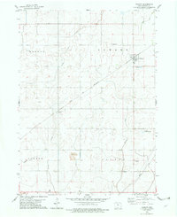
1979 Map of Vincent
USGS Topo · Published 1979About this map
Vincent serves as the primary rail hub on this landscape, situated along the line of the Chicago and North Western railroad. The surrounding terrain is organized into distinct townships, including Badger, Newark, Cooper, and Colfax, reflecting the traditional Midwestern grid of agricultural and civic organization in the late 1970s. The presence of the Rossow County Prairie indicates a preserved segment of the original tallgrass ecosystem amidst the surrounding farmland.
Find a feature on this map
22 named features on this map. Tap any name to fly to it.
Don’t see what you’re looking for? This feature index may not catch every label — zoom into the map to look around manually.
Map Details
Editions of this 1979 Vincent Map
This is the sole edition of this map. No revisions or reprints were ever made.
Other maps of this area

1923 · Lehigh
USGS Topo · 1:62,500

1923 · Fort Dodge
USGS Topo · 1:62,500

1954 · Waterloo
USGS Topo · 1:250,000

1954 · Fort Dodge
USGS Topo · 1:250,000

1955 · Waterloo
USGS Topo · 1:250,000

1957 · Fort Dodge
USGS Topo · 1:250,000

1958 · Fort Dodge
USGS Topo · 1:250,000

1965 · Fort Dodge South
USGS Topo · 1:24,000

1965 · Evanston
USGS Topo · 1:24,000

1978 · Eagle Grove SW
USGS Topo · 1:24,000