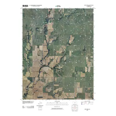
2009 Map of Vine Creek
USGS Topo · Published 2009About this map
The small settlement of Vine Creek stands in the northeast corner of this Ottawa County landscape, where the prairie is defined by a strictly aligned grid of rural roads and meandering watercourses. The local community center is anchored by the Vine Creek Cemetery, located just north of the village site near the intersection of Landmark Dr and Kiowa Rd. This area reflects the late-century agricultural layout of north-central Kansas, where named routes like Homestead Rd and Coronado Rd provide access to the expansive farmlands between the drainages. Several significant waterways carve through the terrain, including the serpentine path of Coal Creek in the southwest and Buckeye Creek to the east. These creeks and the nearby Cole Creek suggest the natural drainage patterns that have dictated field boundaries and property lines for generations of local farmers.
Find a feature on this map
20 named features on this map. Tap any name to fly to it.
Don’t see what you’re looking for? This feature index may not catch every label — zoom into the map to look around manually.
Map Details
Editions of this 2009 Vine Creek Map
This is the sole edition of this map. No revisions or reprints were ever made.
Other maps of this area

1889 · Abilene
USGS Topo · 1:125,000

1891 · Clay Center
USGS Topo · 1:125,000

1892 · Salina
USGS Topo · 1:125,000

1892 · Minneapolis
USGS Topo · 1:125,000

1894 · Abilene
USGS Topo · 1:125,000

1942 · Salina
USGS Topo · 1:125,000

1955 · Niles
USGS Topo · 1:24,000

1955 · New Cambria
USGS Topo · 1:24,000

1955 · Manhattan
USGS Topo · 1:250,000

1955 · Hutchinson
USGS Topo · 1:250,000