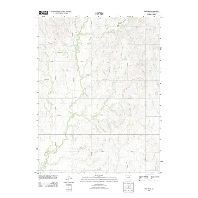
2012 Map of Vine Creek
USGS Topo · Published 2012About this map
Vine Creek anchors the northern reaches of this rural Ottawa County landscape, situated where the high prairie begins its subtle descent into the drainage basins of the Great Plains. The settlement is marked by the presence of Vine Creek Cem, providing a focal point for local genealogical research in this agricultural corridor. The terrain is defined by several north-south watercourses, most notably the meandering paths of Coal Cr, Buckeye Cr, and its namesake Vine Cr. A rigid section-line road network, including thoroughfares like Homestead Rd and Granite Rd, imposes a geometric order over the natural hydrology, reflecting the enduring legacy of the Public Land Survey System in organizing Kansas farmsteads and transport routes.
Find a feature on this map
21 named features on this map. Tap any name to fly to it.
Don’t see what you’re looking for? This feature index may not catch every label — zoom into the map to look around manually.
Map Details
Editions of this 2012 Vine Creek Map
This is the sole edition of this map. No revisions or reprints were ever made.
Other maps of this area

1889 · Abilene
USGS Topo · 1:125,000

1891 · Clay Center
USGS Topo · 1:125,000

1892 · Salina
USGS Topo · 1:125,000

1892 · Minneapolis
USGS Topo · 1:125,000

1894 · Abilene
USGS Topo · 1:125,000

1942 · Salina
USGS Topo · 1:125,000

1955 · Niles
USGS Topo · 1:24,000

1955 · New Cambria
USGS Topo · 1:24,000

1955 · Manhattan
USGS Topo · 1:250,000

1955 · Hutchinson
USGS Topo · 1:250,000