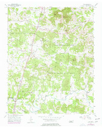
1956 Map of Vine
USGS Topo · Published 1977About this map
Cedars of Lebanon State Forest dominates this central Tennessee landscape, its dense woodlands punctuated by a network of rural roads and scattered homesteads. The terrain is marked by distinctive elevations such as Pilot Knob and Pulltight Hill, while the subterranean character of the region is evidenced by Hermit Cave and several quarries. Settlement patterns follow the winding routes of Stewarts Ferry Pike and Major Road, where small communities like Bairds Mill and Vine established themselves near reliable water sources like Hurricane Creek.
Find a feature on this map
51 named features on this map. Tap any name to fly to it.
Don’t see what you’re looking for? This feature index may not catch every label — zoom into the map to look around manually.
Map Details
Editions of this 1956 Vine Map
2 editions found
Other maps of this area

1908 · Woodbury
USGS Topo · 1:62,500

1916 · Murfreesboro
USGS Topo · 1:62,500

1942 · Statesville
USGS Topo · 1:100,000

1942 · Lebanon
USGS Topo · 1:100,000

1950 · Walterhill
USGS Topo · 1:24,000

1951 · Lebanon
USGS Topo · 1:24,000

1951 · Martha
USGS Topo · 1:24,000

1956 · Vine
USGS Topo · 1:24,000

1956 · Gladeville
USGS Topo · 1:24,000

1956 · Columbia
USGS Topo · 1:250,000