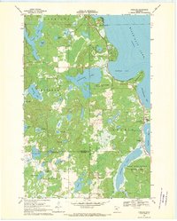
1968 Map of Vineland
USGS Topo · Published 1970About this map
Mille Lacs Lake and the southwestern shoreline of Wigwam Bay dominate this late 1960s survey of the northern Minnesota lake country. The settlement of Vineland serves as a focal point along the shore, featuring the Vineland Sch, Lakewood Cem, and religious landmarks such as Alliance Mission and Little Flower Mission. This area preserves a transition from the open waters of the big lake to a dense network of smaller basins including Whitefish Lake and Ogechie Lake, which is connected to the Rum River.
Find a feature on this map
40 named features on this map. Tap any name to fly to it.
Don’t see what you’re looking for? This feature index may not catch every label — zoom into the map to look around manually.
Map Details
Editions of this 1968 Vineland Map
This is the sole edition of this map. No revisions or reprints were ever made.
Other maps of this area

1912 · Deerwood
USGS Topo · 1:62,500

1914 · Deerwood
USGS Topo · 1:62,500

1916 · Wealthwood
USGS Topo · 1:62,500

1953 · Duluth
USGS Topo · 1:250,000

1958 · Duluth
USGS Topo · 1:250,000

1968 · Onamia NW
USGS Topo · 1:24,000

1968 · Onamia
USGS Topo · 1:24,000
1968 · Platte Lake
USGS Topo · 1:24,000
1968 · Hillman
USGS Topo · 1:24,000
1968 · Hillman SE
USGS Topo · 1:24,000