
1944 Map of Vineyard Haven
USGS Topo · Published 1944About this map
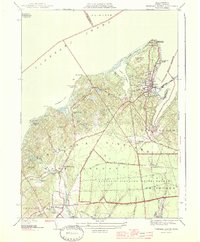
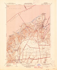
The northern coast of Martha's Vineyard is defined by the sheltered waters of Vineyard Haven Harbor and the navigational landmark of West Chop Lighthouse. This 1944 edition reflects the landscape as it appeared during the height of the Second World War, showing the transition from the bustling village at Vineyard Haven to the expansive Marthas Vineyard State Forest in the interior. The map captures the island's unique hydrography, including the enclosed basins of Lake Tashmoo and Lagoon Pond, alongside numerous small coastal features like Lamberts Cove and Cedar Tree Neck. Inland, the agricultural and local-history character of the island is preserved through the network of brooks and ponds feeding into the Tisbury Great Pond, and the scattered settlements of North Tisbury and West Tisbury. Distinctive landmarks such as the Mink Meadows Golf Club and Tashmoo Golf Course illustrate the established recreational footprint on the island during this era.
Find a feature on this map
58 named features on this map. Tap any name to fly to it.
Don’t see what you’re looking for? This feature index may not catch every label — zoom into the map to look around manually.
Map Details
Editions of this 1944 Vineyard Haven Map
3 editions found
Other maps of this area

1886 · Falmouth
USGS Topo · 1:62,500

1887 · Gay Head
USGS Topo · 1:62,500

1887 · Marthas Vineyard
USGS Topo · 1:62,500

1888 · Falmouth
USGS Topo · 1:62,500

1889 · Gay Head
USGS Topo · 1:62,500

1889 · Marthas Vineyard
USGS Topo · 1:62,500

1893 · Gay Head
USGS Topo · 1:62,500

1893 · Falmouth
USGS Topo · 1:62,500

1894 · Marthas Vineyard
USGS Topo · 1:62,500

1915 · Falmouth
USGS Topo · 1:62,500