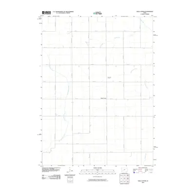
2010 Map of Viola Center
USGS Topo · Published 2010About this map
Viola Center sits at the heart of this rural Audubon County landscape, serving as a primary point of reference for local history and genealogy. The terrain is defined by its drainage patterns, most notably the winding course of the East Nishnabotna River in the west and the South Raccoon River toward the east. This area represents a classic Iowa agricultural grid, where roads like Nighthawk Ave and 140th St divide the land into tidy sections. Near the central settlement, the Viola Center Cemetery provides a tangible link to the families who established these farmsteads. Several waterways including Beaver Creek, Brushy Creek, and Davids Creek bisect the township, illustrating the natural water resources that dictated early land use and the placement of the extensive local road network.
Find a feature on this map
27 named features on this map. Tap any name to fly to it.
Don’t see what you’re looking for? This feature index may not catch every label — zoom into the map to look around manually.
Map Details
Editions of this 2010 Viola Center Map
This is the sole edition of this map. No revisions or reprints were ever made.
Other maps of this area

1954 · Omaha
USGS Topo · 1:250,000

1957 · Omaha
USGS Topo · 1:250,000

1957 · Audubon
USGS Topo · 1:62,500

1958 · Omaha
USGS Topo · 1:250,000

1971 · Coon Rapids South
USGS Topo · 1:24,000

1971 · Viola Center
USGS Topo · 1:24,000

1971 · Dedham
USGS Topo · 1:24,000

1971 · Coon Rapids North
USGS Topo · 1:24,000

1971 · Templeton
USGS Topo · 1:24,000

1971 · North Branch
USGS Topo · 1:24,000