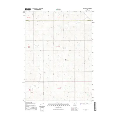
2015 Map of Viola Center
USGS Topo · Published 2015About this map
Viola Center sits at the heart of this rural landscape, serving as the primary hub for a region defined by its intricate drainage networks and gridded agricultural roads. The survey reveals a terrain carved by the headwaters of several significant Iowa waterways, including the E Nishnabotna River and the S Raccoon River. These rivers, along with smaller tributaries like Beaver Cr and Davids Cr, dictate the movement across the countryside, where section lines are maintained by a dense web of gravel routes like Pheasant Ave and 140th St. For those documenting local heritage, the map identifies two key burial grounds: the Viola Center Cem located just north of the town site and the Luccocks Grove Cem near the southern boundary. This 2015 update provides a modern spatial context for these longstanding landmarks within the northern part of Audubon County.
Find a feature on this map
37 named features on this map. Tap any name to fly to it.
Don’t see what you’re looking for? This feature index may not catch every label — zoom into the map to look around manually.
Map Details
Editions of this 2015 Viola Center Map
This is the sole edition of this map. No revisions or reprints were ever made.
Other maps of this area

1954 · Omaha
USGS Topo · 1:250,000

1957 · Omaha
USGS Topo · 1:250,000

1957 · Audubon
USGS Topo · 1:62,500

1958 · Omaha
USGS Topo · 1:250,000

1971 · Coon Rapids South
USGS Topo · 1:24,000

1971 · Viola Center
USGS Topo · 1:24,000

1971 · Dedham
USGS Topo · 1:24,000

1971 · Coon Rapids North
USGS Topo · 1:24,000

1971 · Templeton
USGS Topo · 1:24,000

1971 · North Branch
USGS Topo · 1:24,000