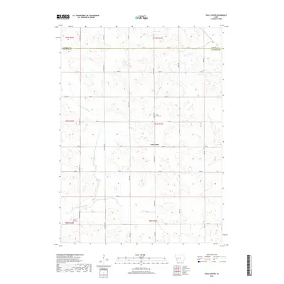
2018 Map of Viola Center
USGS Topo · Published 2018About this map
Viola Center stands as a focal point in this portion of Audubon County, situated near the intersection of several section roads. The landscape is defined by the headwaters and drainage patterns of multiple significant waterways, including the E Nishnabotna River and the S Raccoon River. This map illustrates the transition from the high ground near Viola Center Cem down to the creek valleys of Beaver Cr and Davids Cr. The township grid system is well-established here, with family-named or descriptive roads such as Mahogany Ave and Mockingbird Ave providing access to the fertile agricultural lands. Genealogists and local historians can pinpoint specific burial sites at both the central cemetery and the Luccocks Grove Cem further south, while the undulating topography reveals the complex hydrology of the western Iowa divide.
Find a feature on this map
36 named features on this map. Tap any name to fly to it.
Don’t see what you’re looking for? This feature index may not catch every label — zoom into the map to look around manually.
Map Details
Editions of this 2018 Viola Center Map
This is the sole edition of this map. No revisions or reprints were ever made.
Other maps of this area

1954 · Omaha
USGS Topo · 1:250,000

1957 · Omaha
USGS Topo · 1:250,000

1957 · Audubon
USGS Topo · 1:62,500

1958 · Omaha
USGS Topo · 1:250,000

1971 · Coon Rapids South
USGS Topo · 1:24,000

1971 · Viola Center
USGS Topo · 1:24,000

1971 · Dedham
USGS Topo · 1:24,000

1971 · Coon Rapids North
USGS Topo · 1:24,000

1971 · Templeton
USGS Topo · 1:24,000

1971 · North Branch
USGS Topo · 1:24,000