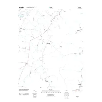
2013 Map of Viola
USGS Topo · Published 2013About this map
Viola serves as a central hub in this Southern Tennessee landscape, where the flatlands of the plateau meet a series of carved valleys and prominent rises. To the north and west, the terrain is defined by the winding course of Hickory Cr and the waters of Harvest Farms Lake, while the eastern portion of the quadrangle transitions into a more complex topography of hollows and knobs. Small settlements and crossroads like Mount Zion, Vervilla, and Chestnut Grove are connected by a network of rural roads, including those named for local families such as Edd Ramsey Rd and John Lawson Rd. The southern reach of the map is particularly distinctive, featuring the sharp elevation of Butterson Knob and the deep indentation of Fultz Cove. Genealogists and local historians can trace the relationship between these early communities and the land, noting landmarks like the Mount Olive Bridge and the secluded Northcutts Cove near Big Spring.
Find a feature on this map
100 named features on this map. Tap any name to fly to it.
Don’t see what you’re looking for? This feature index may not catch every label — zoom into the map to look around manually.
Map Details
Editions of this 2013 Viola Map
This is the sole edition of this map. No revisions or reprints were ever made.
Other maps of this area

1893 · Mc Minnville
USGS Topo · 1:125,000

1895 · Mc Minnville
USGS Topo · 1:125,000

1895 · Sewanee
USGS Topo · 1:125,000

1936 · Morrison
USGS Topo · 1:24,000

1936 · Hillsboro
USGS Topo · 1:24,000

1936 · Cane Hollow
USGS Topo · 1:24,000

1943 · Mc Minnville
USGS Topo · 1:100,000

1952 · Centertown
USGS Topo · 1:24,000

1953 · Chattanooga
USGS Topo · 1:250,000

1953 · Centertown
USGS Topo · 1:24,000