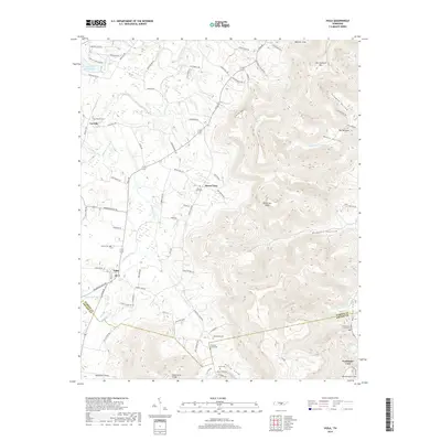
2019 Map of Viola
USGS Topo · Published 2019About this map
Viola and its surrounding Highland Rim landscape are defined by a network of coves and ridges that separate the plateau from the fertile valley floor. In this modern survey, the settlement patterns follow the winding path of Hickory Creek and W Fork Hickory Cr, where small clusters like Vervilla and Mount Zion persist along established routes such as Viola Rd and Morrison Viola Rd. The map is particularly useful for genealogists, as it documents numerous small family and community burial grounds, including Macedonia Cem, Chestnut Grove Cem, and Bascom Cem, often located near prominent terrain features like Chestnut Ridge.
Find a feature on this map
89 named features on this map. Tap any name to fly to it.
Don’t see what you’re looking for? This feature index may not catch every label — zoom into the map to look around manually.
Map Details
Editions of this 2019 Viola Map
This is the sole edition of this map. No revisions or reprints were ever made.
Other maps of this area

1893 · Mc Minnville
USGS Topo · 1:125,000

1895 · Mc Minnville
USGS Topo · 1:125,000

1895 · Sewanee
USGS Topo · 1:125,000

1936 · Morrison
USGS Topo · 1:24,000

1936 · Hillsboro
USGS Topo · 1:24,000

1936 · Cane Hollow
USGS Topo · 1:24,000

1943 · Mc Minnville
USGS Topo · 1:100,000

1952 · Centertown
USGS Topo · 1:24,000

1953 · Chattanooga
USGS Topo · 1:250,000

1953 · Centertown
USGS Topo · 1:24,000