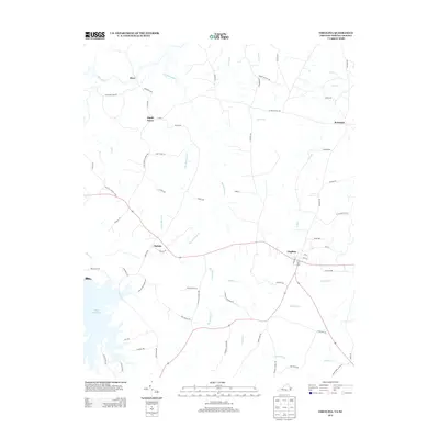
2013 Map of Virgilina
USGS Topo · Published 2013About this map
Virgilina sits at the heart of this landscape, straddling the borderlands of the Virginia and North Carolina Piedmont. The area is defined by a dense network of watercourses, including Big Bluewing Cr, Little Bluewing Cr, and Wolfpit Run, which drain the rolling terrain between rural settlements. Along the western edge, the Mayo Reservoir and the Hyco River introduce significant water bodies into the local geography. Evidence of the region’s social and industrial history is found in the naming of local roads and communities. Small clusters like Christie, Shady Grove, and Red Bank are connected by routes that point to former centers of local activity, such as High Plains School Rd, Zion Hill Church Loop, and High View Church Rd. The presence of Dirgie Mine Rd suggests a history of mineral extraction in this part of the state line region.
Find a feature on this map
70 named features on this map. Tap any name to fly to it.
Don’t see what you’re looking for? This feature index may not catch every label — zoom into the map to look around manually.
Map Details
Editions of this 2013 Virgilina Map
This is the sole edition of this map. No revisions or reprints were ever made.
Other maps of this area

1941 · Clarksville
USGS Topo · 1:48,000

1943 · Clarksville
USGS Topo · 1:62,500

1943 · Roxboro
USGS Topo · 1:62,500

1953 · Oxford
USGS Topo · 1:62,500

1953 · South Boston
USGS Topo · 1:62,500

1953 · Greensboro
USGS Topo · 1:250,000

1954 · Greensboro
USGS Topo · 1:250,000

1957 · South Boston
USGS Topo · 1:62,500

1957 · Clarksville
USGS Topo · 1:62,500

1962 · Greensboro
USGS Topo · 1:250,000