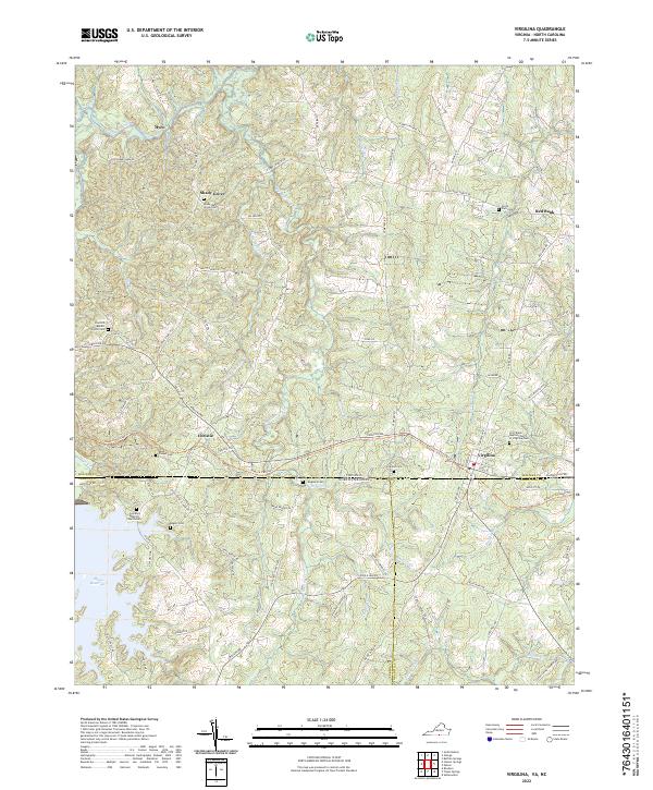
2022 Map of Virgilina
USGS Topo · Published 2022About this map
Virgilina straddles the state line where Halifax County, Virginia, meets Person and Granville counties in North Carolina. This borderland landscape is defined by the headwaters of the Hyco River and the sprawling reach of the Mayo Reservoir. The settlement pattern follows older agricultural ridges and the path of the Tobacco Heritage Trl, which connects the small communities of Christie and Red Bank. Local history is deeply rooted in the many rural congregational sites scattered across the terrain, including the First Black Baptist Church of Virgilina Cem and the Zion Hill Baptist Church Cem. The map reveals a sophisticated network of waterways like Aarons Cr and Big Bluewing Cr, which once supported the tobacco-driven economy of the Southside Virginia and North Carolina Piedmont.
Find a feature on this map
83 named features on this map. Tap any name to fly to it.
Don’t see what you’re looking for? This feature index may not catch every label — zoom into the map to look around manually.
Map Details
Editions of this 2022 Virgilina Map
This is the sole edition of this map. No revisions or reprints were ever made.
Other maps of this area

1941 · Clarksville
USGS Topo · 1:48,000

1943 · Clarksville
USGS Topo · 1:62,500

1943 · Roxboro
USGS Topo · 1:62,500

1953 · Oxford
USGS Topo · 1:62,500

1953 · South Boston
USGS Topo · 1:62,500

1953 · Greensboro
USGS Topo · 1:250,000

1954 · Greensboro
USGS Topo · 1:250,000

1957 · South Boston
USGS Topo · 1:62,500

1957 · Clarksville
USGS Topo · 1:62,500

1962 · Greensboro
USGS Topo · 1:250,000