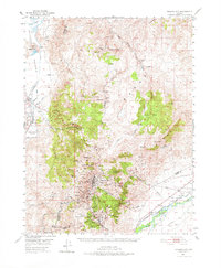
1960 Map of Virginia City
USGS Topo · Published 1976About this map
Virginia City and the historic Comstock Lode mining district dominate this mid-century topographic record, showing the dense concentration of mine shafts and infrastructure surrounding Gold Hill and Silver City. The map traces the underground path of the Sutro Tunnel, reaching from the high peaks toward the Carson River valley. This alignment illustrates the monumental engineering required to drain the deep silver mines of the Virginia Range during its peak industrial era.
Find a feature on this map
54 named features on this map. Tap any name to fly to it.
Don’t see what you’re looking for? This feature index may not catch every label — zoom into the map to look around manually.
Map Details
Editions of this 1960 Virginia City Map
This is the sole edition of this map. No revisions or reprints were ever made.
Other maps of this area

1890 · Wadsworth
USGS Topo · 1:125,000

1891 · Carson
USGS Topo · 1:125,000

1891 · Wabuska
USGS Topo · 1:125,000

1891 · Reno
USGS Topo · 1:125,000

1892 · Wadsworth
USGS Topo · 1:125,000

1893 · Carson
USGS Topo · 1:125,000

1893 · Reno
USGS Topo · 1:125,000

1894 · Wadsworth
USGS Topo · 1:125,000

1894 · Wabuska
USGS Topo · 1:125,000

1950 · Virginia City
USGS Topo · 1:62,500