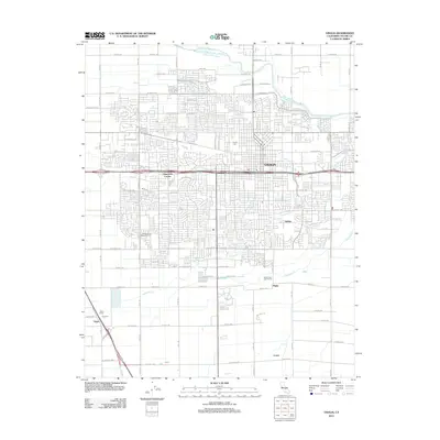
2012 Map of Visalia
USGS Topo · Published 2012About this map
Visalia expansion into the surrounding San Joaquin Valley floor is documented here, showing a grid-based suburban development pattern integrated with established agricultural and hydrological features. The Saint Johns River defines the northern reaches of the quadrangle, while several distributaries, including Mill Creek, Packwood Creek, and Cameron Creek, weave through the residential and commercial blocks. This era captures the transition of periphery agricultural land into the urban fabric, exemplified by the College of the Sequoias Farm and the sprawling orchards near Tagus Ranch. To the south and east, smaller named locales such as Ambler, Higby, and Loma represent the traditional valley settlements that are increasingly connected by the modern road network. Cultural landmarks like the Visalia Cemetery and the Sierra View Golf Course provide spatial anchors within the developing city limits.
Find a feature on this map
53 named features on this map. Tap any name to fly to it.
Don’t see what you’re looking for? This feature index may not catch every label — zoom into the map to look around manually.
Map Details
Editions of this 2012 Visalia Map
This is the sole edition of this map. No revisions or reprints were ever made.
Other maps of this area

1925 · Tulare
USGS Topo · 1:31,680

1926 · Goshen
USGS Topo · 1:31,680

1926 · Ivanhoe
USGS Topo · 1:31,680

1926 · Exeter
USGS Topo · 1:31,680

1927 · Traver
USGS Topo · 1:31,680

1927 · Cairns Corner
USGS Topo · 1:31,680

1927 · Monson
USGS Topo · 1:31,680

1927 · Paige
USGS Topo · 1:31,680

1927 · Visalia
USGS Topo · 1:31,680

1927 · Tulare
USGS Topo · 1:31,680