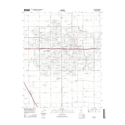
2015 Map of Visalia
USGS Topo · Published 2015About this map
The Saint Johns River and a dense network of irrigation channels define the agricultural and urban landscape of the San Joaquin Valley near the city of Visalia. This survey documents a complex hydrological system of ditches and creeks, such as Modoc Ditch, Persian Ditch, and Packwood Creek, which have historically sustained the region's orchards and fields. Outside the primary city limits, smaller named localities like Chinowths Corner and Ambler appear alongside educational and civic landmarks like the College of the Sequoias and the Visalia Cemetery. The map captures the transition from a concentrated urban core to the surrounding rural periphery, where outlying points like Tagus, Higby, and Loma anchor the southern and western reaches of the quadrangle.
Find a feature on this map
49 named features on this map. Tap any name to fly to it.
Don’t see what you’re looking for? This feature index may not catch every label — zoom into the map to look around manually.
Map Details
Editions of this 2015 Visalia Map
This is the sole edition of this map. No revisions or reprints were ever made.
Other maps of this area

1925 · Tulare
USGS Topo · 1:31,680

1926 · Goshen
USGS Topo · 1:31,680

1926 · Ivanhoe
USGS Topo · 1:31,680

1926 · Exeter
USGS Topo · 1:31,680

1927 · Traver
USGS Topo · 1:31,680

1927 · Cairns Corner
USGS Topo · 1:31,680

1927 · Monson
USGS Topo · 1:31,680

1927 · Paige
USGS Topo · 1:31,680

1927 · Visalia
USGS Topo · 1:31,680

1927 · Tulare
USGS Topo · 1:31,680