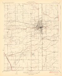
1927 Map of Visalia
USGS Topo · Published 1927About this map
Visalia serves as the focal point of this 1924 survey, revealing a dense grid of streets surrounded by an intricate network of water management systems essential to Central Valley agriculture. The landscape is defined by the diverging paths of St Johns River, Mill Creek, and Packwood Creek, which are supplemented by engineered waterways like the Tulare Irrigation District Canal. This period of development shows the city's reliance on both the Southern Pacific and the Atchison Topeka and Santa Fe railroads, which facilitated the movement of goods from the surrounding farms and orchards.
Find a feature on this map
24 named features on this map. Tap any name to fly to it.
Don’t see what you’re looking for? This feature index may not catch every label — zoom into the map to look around manually.
Map Details
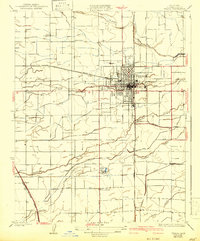
Editions of this 1927 Visalia Map
3 editions found
Other maps of this area

1925 · Tulare
USGS Topo · 1:31,680

1926 · Goshen
USGS Topo · 1:31,680

1926 · Ivanhoe
USGS Topo · 1:31,680

1926 · Exeter
USGS Topo · 1:31,680

1927 · Traver
USGS Topo · 1:31,680

1927 · Cairns Corner
USGS Topo · 1:31,680

1927 · Monson
USGS Topo · 1:31,680

1927 · Paige
USGS Topo · 1:31,680

1927 · Visalia
USGS Topo · 1:31,680

1927 · Tulare
USGS Topo · 1:31,680