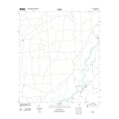
2012 Map of Vista
USGS Topo · Published 2012About this map
The Suwannee River carves a serpentine path through this Dixie County landscape, defining the character of local settlements and topography. Small riverfront communities like Fowlers Bluff and Week Landing sit along its banks, while Little Turkey Island marks a significant bend in the river's course near the southern edge of the map. Away from the main channel, the terrain is shaped by unique hydrological features including Lime Sink and California Cr, reflecting the region's porous limestone geography.
Find a feature on this map
39 named features on this map. Tap any name to fly to it.
Don’t see what you’re looking for? This feature index may not catch every label — zoom into the map to look around manually.
Map Details
Editions of this 2012 Vista Map
This is the sole edition of this map. No revisions or reprints were ever made.
Other maps of this area

1954 · Eugene
USGS Topo · 1:24,000

1954 · Cross City SW
USGS Topo · 1:24,000

1954 · Suwannee
USGS Topo · 1:24,000

1954 · Manatee Springs
USGS Topo · 1:24,000

1954 · Chiefland SW
USGS Topo · 1:24,000

1954 · Vista
USGS Topo · 1:24,000

1954 · East Pass
USGS Topo · 1:24,000

1954 · Gainesville
USGS Topo · 1:250,000

1955 · Shired Island
USGS Topo · 1:24,000

1958 · Gainesville
USGS Topo · 1:250,000