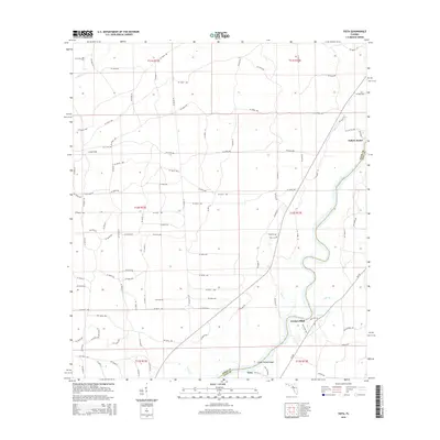
2015 Map of Vista
USGS Topo · Published 2015About this map
The Suwannee River snakes through the eastern portion of this landscape, defining the boundary between Dixie Co and Levy Co. The riverine geography is marked by distinctive features such as Little Turkey Island and various drainage points like Week Creek and Cedar Branch. Small settlements and landings punctuate the river's path, most notably Fowlers Bluff and Yellow Jacket, which serve as focal points for the sparsely populated coastal plain.
Find a feature on this map
111 named features on this map. Tap any name to fly to it.
Don’t see what you’re looking for? This feature index may not catch every label — zoom into the map to look around manually.
Map Details
Editions of this 2015 Vista Map
This is the sole edition of this map. No revisions or reprints were ever made.
Other maps of this area

1954 · Eugene
USGS Topo · 1:24,000

1954 · Cross City SW
USGS Topo · 1:24,000

1954 · Suwannee
USGS Topo · 1:24,000

1954 · Manatee Springs
USGS Topo · 1:24,000

1954 · Chiefland SW
USGS Topo · 1:24,000

1954 · Vista
USGS Topo · 1:24,000

1954 · East Pass
USGS Topo · 1:24,000

1954 · Gainesville
USGS Topo · 1:250,000

1955 · Shired Island
USGS Topo · 1:24,000

1958 · Gainesville
USGS Topo · 1:250,000