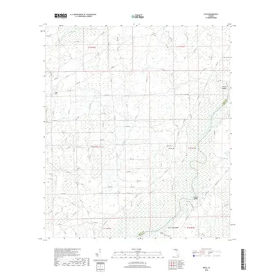
2018 Map of Vista
USGS Topo · Published 2018About this map
The Suwannee River carves a winding path along the boundary of Dixie Co and Levy Co, anchoring a landscape defined by wetlands and small riverfront settlements. This 2018 survey reveals a sparse human footprint centered on the water, with Fowlers Bluff and Yellow Jacket serving as primary points of orientation along the eastern bank. To the west, the expansive California Swamp dominates the terrain, drained by California Cr and dotted with natural features like Lime Sink. The map provides a detailed view of the local road network, including Co Rd 349 and numerous forest access routes like SE 434 Ave. Small-scale historical markers, such as Keen Cem and the settlement at Vista, offer valuable data points for those researching family ties to this riverine region.
Find a feature on this map
115 named features on this map. Tap any name to fly to it.
Don’t see what you’re looking for? This feature index may not catch every label — zoom into the map to look around manually.
Map Details
Editions of this 2018 Vista Map
This is the sole edition of this map. No revisions or reprints were ever made.
Other maps of this area

1954 · Eugene
USGS Topo · 1:24,000

1954 · Cross City SW
USGS Topo · 1:24,000

1954 · Suwannee
USGS Topo · 1:24,000

1954 · Manatee Springs
USGS Topo · 1:24,000

1954 · Chiefland SW
USGS Topo · 1:24,000

1954 · Vista
USGS Topo · 1:24,000

1954 · East Pass
USGS Topo · 1:24,000

1954 · Gainesville
USGS Topo · 1:250,000

1955 · Shired Island
USGS Topo · 1:24,000

1958 · Gainesville
USGS Topo · 1:250,000