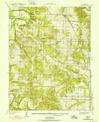
1938 Map of Vista
USGS Topo · Published 1952About this map
Vista and Tracy anchor the northern reaches of this rural St. Clair County landscape, which sits at a crossroads of the ST Louis and San Francisco railway lines. This survey captures a robust network of agrarian community life, marked by a high density of rural schoolhouses and family burial grounds serving the townships of Doyal, Washington, and Collins. From the northern Bradford Sch to the southern Prairie Sch, these small institutions define the social geography of the late 1930s. The western edge is dominated by the winding course of the Sac River, while the interior is carved by a complex system of tributaries including Coon Creek and Buckheart Branch. The terrain rises to distinct landmarks like Shryers Bluff and Long Ridge, providing a clear view of the topography before mid-century infrastructure changed the regional character.
Find a feature on this map
38 named features on this map. Tap any name to fly to it.
Don’t see what you’re looking for? This feature index may not catch every label — zoom into the map to look around manually.
Map Details
Editions of this 1938 Vista Map
2 editions found
Other maps of this area

1886 · Stockton
USGS Topo · 1:125,000

1887 · Clinton
USGS Topo · 1:125,000

1894 · Clinton
USGS Topo · 1:125,000

1938 · Monegaw Springs
USGS Topo · 1:24,000

1938 · Roscoe
USGS Topo · 1:24,000

1938 · Vista
USGS Topo · 1:24,000

1939 · Caplinger Mills
USGS Topo · 1:24,000

1939 · Osceola
USGS Topo · 1:24,000

1939 · Arnica
USGS Topo · 1:24,000

1940 · Roscoe
USGS Topo · 1:24,000