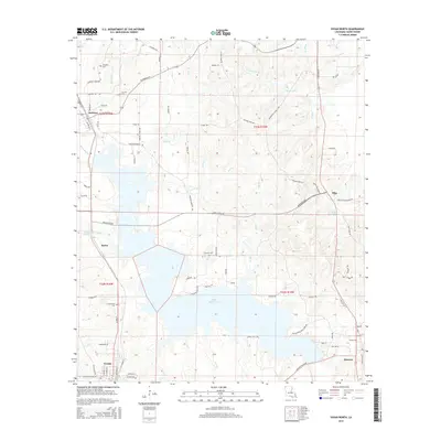
2015 Map of Vivian North
USGS Topo · Published 2015About this map
Rodessa and the surrounding piney woods of northern Caddo Parish appear here in this 2015 update, characterized by a dense network of local roads and watercourses. The landscape is defined by the expansive Black Bayou Lake and its numerous tributaries, including Tyson Br and Gray Br. Small, established communities like Myrtis and Mira are documented alongside significant genealogical sites such as Rodessa Cemetery and Antioch Cem. A notable industrial legacy is implied by the presence of Standard-Oil Rd near the northern border, while recreational or local landmarks like Gator Hole Fwy and Myrtis Mill Pond illustrate the specific regional character of the bayou country. The southern edge of the sheet captures the residential outskirts of Vivian and Hosston, providing a clear record of these settlements in the early twenty-first century.
Find a feature on this map
91 named features on this map. Tap any name to fly to it.
Don’t see what you’re looking for? This feature index may not catch every label — zoom into the map to look around manually.
Map Details
Editions of this 2015 Vivian North Map
This is the sole edition of this map. No revisions or reprints were ever made.
Other maps of this area

1907 · Atlanta
USGS Topo · 1:62,500

1910 · Atlanta
USGS Topo · 1:62,500

1932 · Hosston NW
USGS Topo · 1:31,680

1932 · Hosston NE
USGS Topo · 1:31,680

1932 · Hosston SW
USGS Topo · 1:31,680

1932 · Hosston SE
USGS Topo · 1:31,680

1944 · Kildare
USGS Topo · 1:62,500

1948 · Kildare
USGS Topo · 1:62,500

1948 · Vivian
USGS Topo · 1:62,500

1952 · Doddridge SE
USGS Topo · 1:24,000