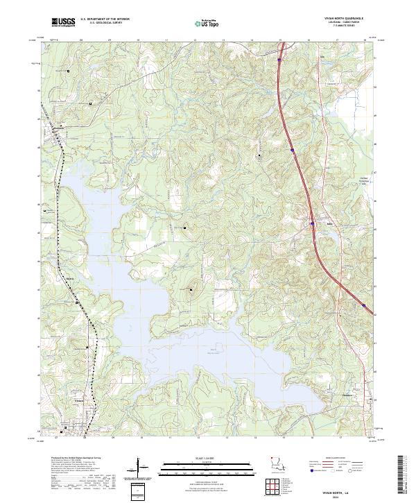
2024 Map of Vivian North
USGS Topo · Published 2024About this map
Rodessa and the northern reaches of Vivian anchor this corner of Caddo Parish, where the geography is defined by the expansive Black Bayou Lake and its intricate network of tributaries. The landscape is a mosaic of small-town settlement and water management, evidenced by features like Myrtis Mill Pond and Mira Pond. For those researching family history, the map preserves the location of numerous burial grounds, including the Vivian Cem Old Section, Antioch Cem, and Munnerlyn Chapel Cem. The transition from the clustered streets of Rodessa to the rural expanses near Ida and Mira highlights a region still heavily influenced by its creek systems, such as Hoss Creek and Horse Creek. This survey provides a contemporary look at the rural road network and the enduring community landmarks that define the parish's northwestern border.
Find a feature on this map
103 named features on this map. Tap any name to fly to it.
Don’t see what you’re looking for? This feature index may not catch every label — zoom into the map to look around manually.
Map Details
Editions of this 2024 Vivian North Map
This is the sole edition of this map. No revisions or reprints were ever made.
Other maps of this area

1907 · Atlanta
USGS Topo · 1:62,500

1910 · Atlanta
USGS Topo · 1:62,500

1932 · Hosston NW
USGS Topo · 1:31,680

1932 · Hosston NE
USGS Topo · 1:31,680

1932 · Hosston SW
USGS Topo · 1:31,680

1932 · Hosston SE
USGS Topo · 1:31,680

1944 · Kildare
USGS Topo · 1:62,500

1948 · Kildare
USGS Topo · 1:62,500

1948 · Vivian
USGS Topo · 1:62,500

1952 · Doddridge SE
USGS Topo · 1:24,000