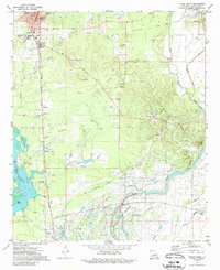
1971 Map of Vivian South
USGS Topo · Published 1989About this map
Oil and gas fields dominate this Caddo Parish landscape in the early 1970s, revealing an intricate network of industrial infrastructure intertwined with traditional rural settlements. The southern reaches of Vivian and the specialized worker communities of Superior and Oil City are shown alongside the extensive Kansas City Southern railroad line. This transportation corridor was vital for the extraction industry, which is marked by numerous oil fields, drill holes, and a complex web of pipelines.
Find a feature on this map
55 named features on this map. Tap any name to fly to it.
Don’t see what you’re looking for? This feature index may not catch every label — zoom into the map to look around manually.
Map Details
Editions of this 1971 Vivian South Map
2 editions found
Other maps of this area

1932 · Hosston NW
USGS Topo · 1:31,680

1932 · Hosston NE
USGS Topo · 1:31,680

1932 · Hosston SW
USGS Topo · 1:31,680

1932 · Hosston SE
USGS Topo · 1:31,680

1932 · Shreveport NE
USGS Topo · 1:31,680

1944 · Kildare
USGS Topo · 1:62,500

1944 · Caddo Lake
USGS Topo · 1:62,500

1946 · Caddo Lake
USGS Topo · 1:62,500

1948 · Kildare
USGS Topo · 1:62,500

1948 · Mooringsport
USGS Topo · 1:62,500