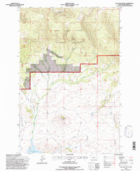
1995 Map of Volcano Butte
USGS Topo · Published 1997About this map
Lewis and Clark National Forest defines the northern reaches of this high-altitude landscape, where the rugged topography is carved by drainage systems like Sawmill Creek and Dry Creek. The area’s industrial history is anchored by the Copper State Mine, situated near the headwaters of Gels Creek. This site reflects the mining activity that once characterized the Little Belt Mountains, while the broader terrain transitions from the timbered heights of the Kings Hill Ranger District down to the open waters of Lake Sutherlin in the south.
Find a feature on this map
18 named features on this map. Tap any name to fly to it.
Don’t see what you’re looking for? This feature index may not catch every label — zoom into the map to look around manually.
Map Details
Editions of this 1995 Volcano Butte Map
This is the sole edition of this map. No revisions or reprints were ever made.
Other maps of this area

1886 · Little Belt Mts.
USGS Topo · 1:250,000

1894 · Little Belt Mts.
USGS Topo · 1:250,000

1897 · Little Belt Mts.
USGS Topo · 1:250,000

1898 · Little Belt Mts.
USGS Topo · 1:250,000

1902 · Little Belt Mts.
USGS Topo · 1:250,000

1948 · White Sulphur Springs
USGS Topo · 1:250,000

1958 · White Sulphur Springs
USGS Topo · 1:250,000

1961 · White Sulphur Springs
USGS Topo · 1:250,000
1961 · Kings Hill
USGS Topo · 1:24,000
1961 · Sand Point
USGS Topo · 1:24,000