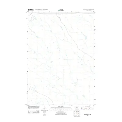
2012 Map of Volunteer NE
USGS Topo · Published 2012About this map
Station Elm Cr and its numerous tributaries dominate this part of Butte County, forming a dendritic drainage pattern typical of the western South Dakota plains. The landscape is defined by the convergence of several seasonally active waterways, including Mud Elm Cr, Crooked Elm Cr, and Eightmile Cr. These drainage systems reflect the hydrological character of the region where water flow dictates the local topography and historical land use.
Find a feature on this map
9 named features on this map. Tap any name to fly to it.
Don’t see what you’re looking for? This feature index may not catch every label — zoom into the map to look around manually.
Map Details
Editions of this 2012 Volunteer NE Map
This is the sole edition of this map. No revisions or reprints were ever made.
Other maps of this area

1913 · Newell
USGS Topo · 1:125,000

1951 · Volunteer
USGS Topo · 1:24,000

1951 · Volunteer SE
USGS Topo · 1:24,000

1953 · Rapid City
USGS Topo · 1:250,000

1957 · Rapid City
USGS Topo · 1:250,000

1959 · Fairpoint SW
USGS Topo · 1:24,000
1959 · Volunteer NW
USGS Topo · 1:24,000
1959 · Volunteer NE
USGS Topo · 1:24,000

1959 · Fairpoint NW
USGS Topo · 1:24,000
1973 · Owl Butte
USGS Topo · 1:24,000